Home
The Map
List View


 Flusshinweise
Befahrbarkeit
English Summary
Karte Einbetten
Systemstatus
Kontakt und Team
Datenlieferanten
Overview
Download
Rivermap Japan
The Map
List View
Befahrbarkeit
English Summary
Karte Einbetten
Systemstatus
Kontakt und Team
Datenlieferanten
Overview
Download
Rivermap Japan
![]() "Rivermap Supporter" Group
"Rivermap Supporter" Group
Flusshinweise
Grande Eau: Col des Mosses - Aigle
IV+ 3.04 km direct

Grande Eau @ Aigle 4.66 m³/s @ 12:30
7 | 9 m³/s
Resultate 1 - 6 von 6
Info | 14 m³/s | 06.06.2021
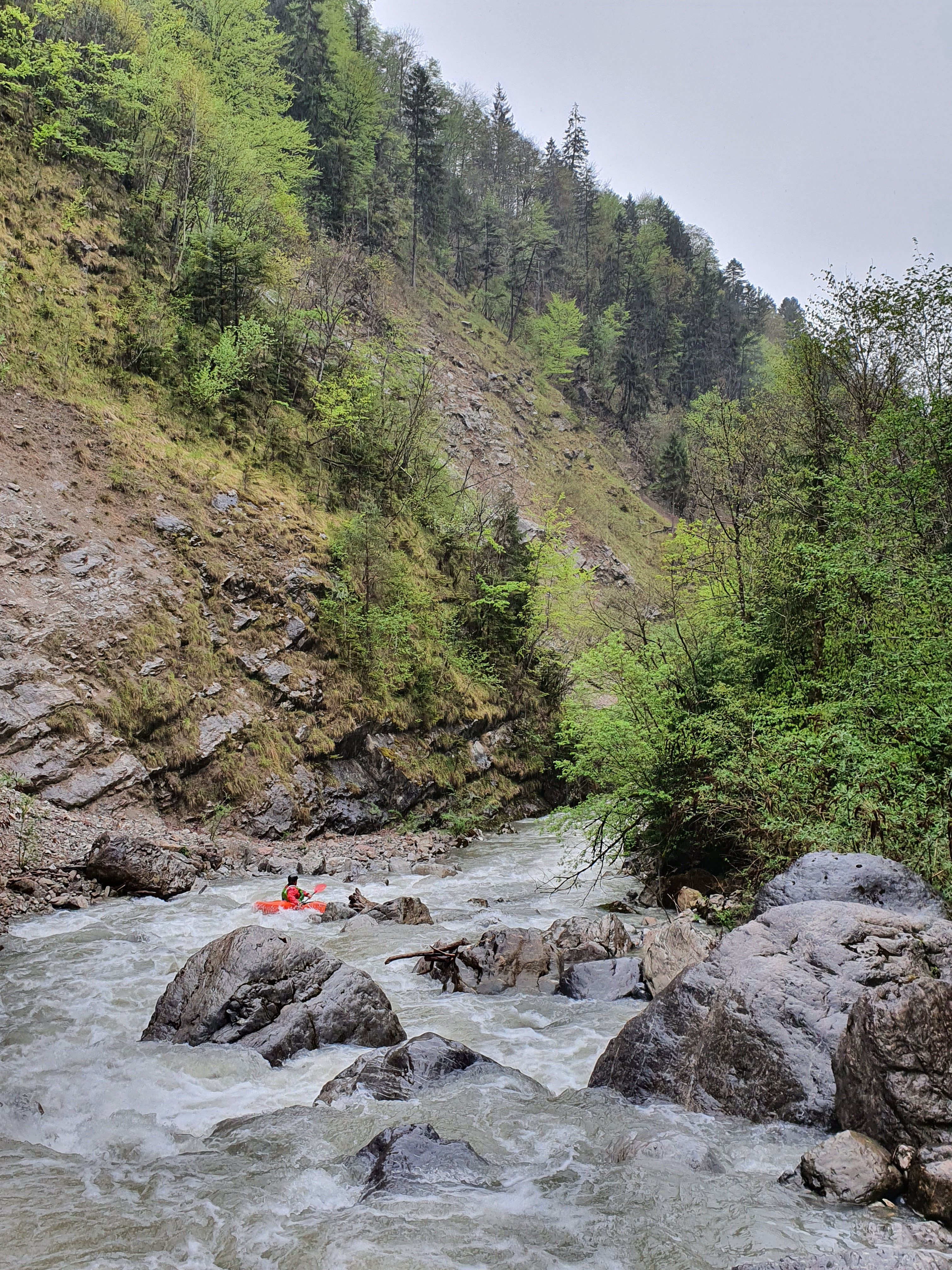
14m^3/s on the gauge with no water coming out of the damn released. Around 12m^3/s in the section it was more V- at the beginning. 1 tree that we needed to partage the others were dogeable. Really continuous !

")

Bewertung NW-MW-HW
BE - 11m^3/s
ME - 14m^3/s
HE - 17m^3/s
The gauge is under a forced conduite which realesed up to 6.5m^3/s more than in the section. The river flow level is the gauge level minus 6.5m^3/s.
ME - 14m^3/s
HE - 17m^3/s
The gauge is under a forced conduite which realesed up to 6.5m^3/s more than in the section. The river flow level is the gauge level minus 6.5m^3/s.
Info | 12.5 m³/s | 07.05.2021
some more pictures


Info | 12.5 m³/s | 07.05.2021
We were there on May 7, 2021.
River was pretty clean of wood thanks to local kayakers work, yet there where still some logs. It's the main danger here.
We had 12.5 m3/s, which was just enough, should be better with a few m3 more.
Don't drive hours for that one !
River was pretty clean of wood thanks to local kayakers work, yet there where still some logs. It's the main danger here.
We had 12.5 m3/s, which was just enough, should be better with a few m3 more.
Don't drive hours for that one !


Befahrbarkeit
Bei der letzten Fahrt am 1.4.2012 hatte es ziehmlich viele Bäume im
Fluss.
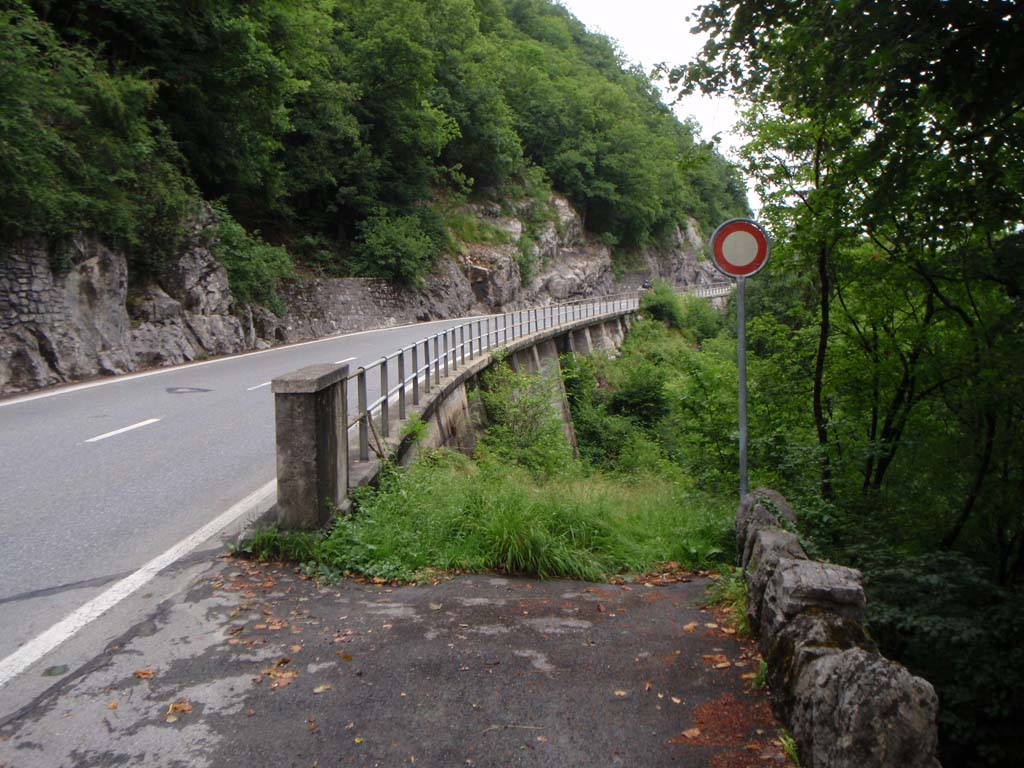
Col des Mosses: Von hier geht ein Weg zur Einbootstelle.
Fluss.
Col des Mosses: Von hier geht ein Weg zur Einbootstelle.
nach oben