Home
The Map
List View


 Flusshinweise
Befahrbarkeit
English Summary
Karte Einbetten
Systemstatus
Kontakt und Team
Datenlieferanten
Overview
Download
Rivermap Japan
The Map
List View
Befahrbarkeit
English Summary
Karte Einbetten
Systemstatus
Kontakt und Team
Datenlieferanten
Overview
Download
Rivermap Japan
![]() "Rivermap Supporter" Group
"Rivermap Supporter" Group
Flusshinweise
Roya: Gorges de Saorge (Fontan - Pont de Gémion)
IV 3.29 km direct
Resultate 1 - 8 von 8
Dangers here : https://www.google.com/maps/d/u/0/viewer?mid=1TnajnD7qod7trxS5mjwbfIbz82YB17d6&ll=43.97117640411553%2C7.5343535500000325&z=13
At 43.98454,7.54961 there are two bigger rocks that make a syphon. Eddy out on the left before the bridge and traverse right of those 2 rocks into a small drop with an eddy.
Info
the gauge is very hard to reach as you cannot get close enough.
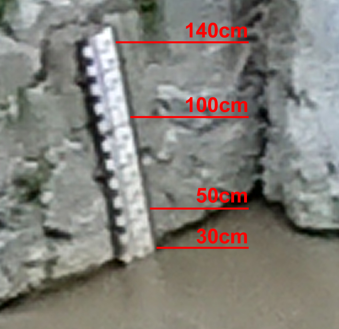
here is a picture showing it that might help reading it. on that day it was at 30cm. you can barely see the 100cm mark. the top is 140cm.
here is a picture showing it that might help reading it. on that day it was at 30cm. you can barely see the 100cm mark. the top is 140cm.
Info
to get an idea about the difficulties, you could inspect two features.
to reach the first, take the exit between the two tunnels. drive 500m upstream along the river until you reach a bridge. the feature is right there.
for the second feature, walk up from the exit along the river. the road is heavily weathered and barred. after 800m you reach the gauge. another 100m up and you see a cateract with big stones and quite some gradient.
Befahrbarkeit | 5.2015
to get info about the level of this section, contact one of the rafting companies in breil. for example:
https://www.nicerafting.com
tel +33 6 81 56 21 56
coords: 43.940391, 7.516429
https://www.nicerafting.com
tel +33 6 81 56 21 56
coords: 43.940391, 7.516429
Bewertung NW-MW-HW
Lattenpegel bei 800m oberhalb der Brücke von Gémion:
NW=0 cm
MW=20 cm
HW=30-60 cm
NW=0 cm
MW=20 cm
HW=30-60 cm
nach oben